 "TheRealBicycleBuck" (therealbicyclebuck)
03/16/2019 at 21:51 • Filed to: None
 8
8
 11
11
 "TheRealBicycleBuck" (therealbicyclebuck)
03/16/2019 at 21:51 • Filed to: None |  8 8
|  11 11 |
I DID IT! First solo cross-country flight! Total distance was 175 miles. Contrary to what the flight plan says, t he total time was 2.7 hours. That little detail came back to bite me in the ass.
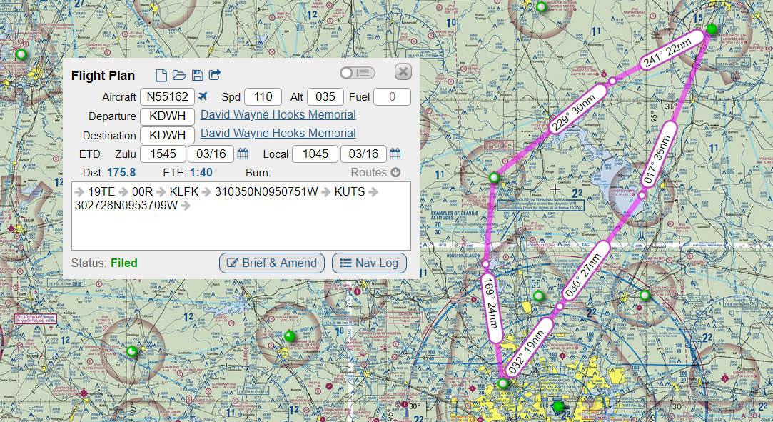
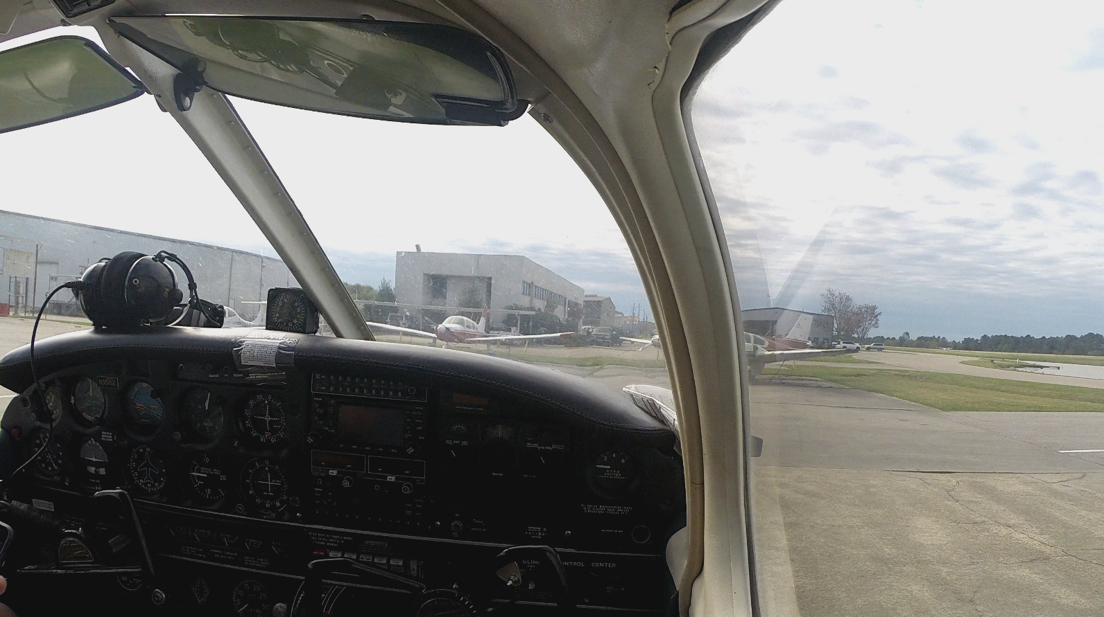
The flight was really uneventful. I filed my flight plan, prepped the plane, and got out of Hooks airport around 11:00. I tried using my GoPro to get some video, but it didn’t turn out like I planned. The video quit less than half an hour into the flight. I’ve learned that reformatting the SD card should fix that problem.
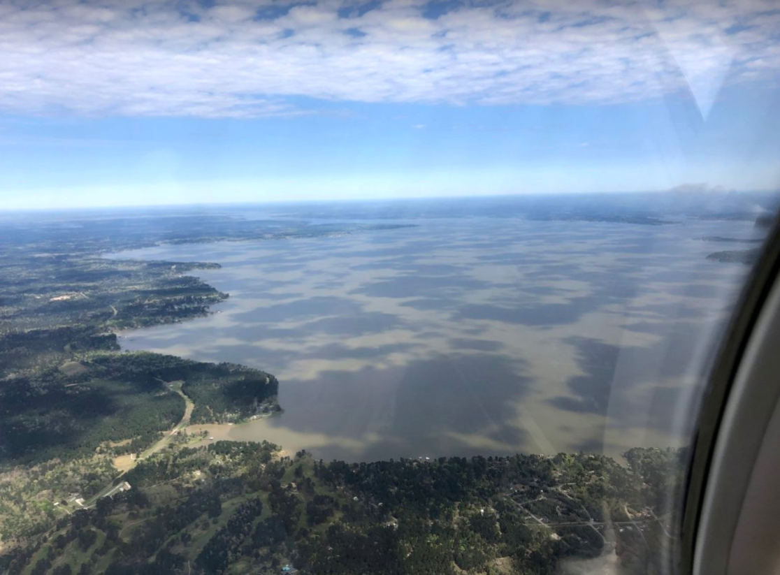
The flight out took me over Lake Livingston. By the time I got there, some high-level cirrus clouds made the lake look like a Holstein cow. On the right side of the photo is some smoke. It looked like someone was burning off the brush from clearing their land. There was another plume of smoke further north. That one looked like a controlled burn in a forest. I wish I had a picture of it.
There was a little excitement when I arrived at Lufkin. As I transitioned into their airspace, I switched from flight following out of Houston to the local comms. There isn’t a tower, so it’s good practice to call out your actions before you do them. I started calling my approach, then my position as I entered the pattern. To my surprise, there was a small plane, perhaps an RV or a Thorp T-18, sitting on the runway as I made my downwind. Whoever was flying wasn’t communicating.
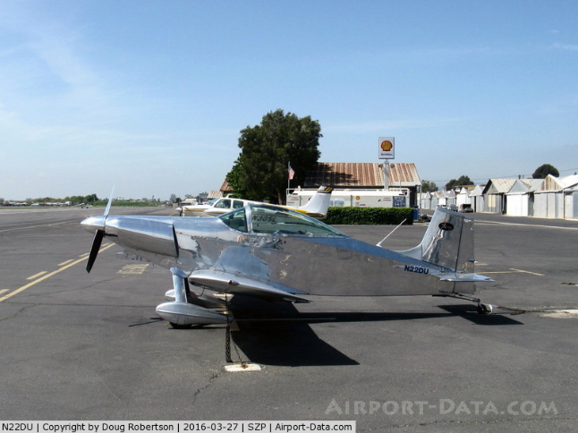
I gave him plenty of room so he could get into the air before I landed. There was a Bonanza coming in from the east and I wanted to get down before he arrived. Instead of a simple touch-and-go, I stopped and taxied back. I got into the air again and turned to toward Hunstville. By the time I got out of Lufkin, there were three other aircraft sharing the skies with me.
The winds in Huntsville were “variable” so I had options, either runway 18 (landing to the south) or 36 (landing to the north). Other t raffic was landing on 18, so I went with the flow. The wind sock was flat, but the grass showed a slight breeze from the north. I wanted to take off into the breeze, but more incoming traffic forced my hand and I had to take off to the south. If I hadn’t, it would have been like driving onto the wrong side of the freeway. I would have been face to face with incoming traffic.
Remember when I mentioned a little detail that would bite me in the ass? Here’s where it comes into play. I wasn’t aware that the app I used to file my flight plan didn’t take into account wind and stops, so it was about this time that my flight plan expired and I hadn’t called to report in. A call came in from an 800 number and I assumed it was a robocall so I didn’t answer it. A few minutes later, I received a text from my flight instructor. Flight Service was getting ready to send out search and rescue.

Who is Flight Service? Well, the idea is that you file a flight plan with them and if you don’t call to let them know you landed safely within the allotted time in your flight plan , they will send out search and rescue.
Since I was using flight following and was in touch with Houston Control, I radioed them and asked them to cancel the flight plan. They asked me if I was planning to stay in Huntsville. No, of course. So they thought it was best to keep the plan active until I landed at my final destination. I though that all was well since Houston knew where I was.
I was wrong.
I learned later that Flight Services doesn’t talk to anyone except the person who filed the plan, the airport where the pilot is supposed to land, or your base of operations, in this case, the flight school. After I landed at Hooks, the tower asked me to call Flight Services as soon as I parked the plane. My instructor met me at the plane and told me to call Flight Services immediately.
I called Flight Services.
One would expect that if they were so worried about saving pilot’s lives, Flight Services would answer the phone immediately. Nope. I was on hold for at least five minutes. T ha t was probably because there were lots of pilots calling in, right? Nope! Even the hold message said there were no calls ahead of me.
While I was on hold, I was preparing myself for an ass-chewing. S omeone finally answered the phone and I gave them my information. Did I get an ass-chewing? No. They thanked me for closing my flight plan. That was it.
I expect to hear something from the lead flight instructor tomorrow . He’s an ex-FAA guy and is a stickler for the rules. He’s already left a message for my flight instructor. I’ll know more tomorrow.
The plan for tomorrow is a review flight with a senior instructor. I’ve never flown with this guy before, so it should be interesting. I’m pretty wiped out from the long flight today, so I’ll be keeping tomorrow’s flight short.
Until tomorrow, Oppo!
 itranthelasttimeiparkedit
> TheRealBicycleBuck
03/16/2019 at 22:00 |
|
Isn’t hooks the one with the popular little restaurant in it? My wife and I both grew up in that area
 pip bip - choose Corrour
> TheRealBicycleBuck
03/16/2019 at 22:03 |
|
something to keep in mind when filing future flight plans
 TheRealBicycleBuck
> itranthelasttimeiparkedit
03/16/2019 at 22:30 |
|
I think there’s a restaurant at the FBO. The flight school I go to is at the other end of the airport, so I’ve never visited the FBO.
 ttyymmnn
> TheRealBicycleBuck
03/16/2019 at 22:39 |
|
The flight was really uneventful.
Which is exactly what you want.
Congrats.
 TheRealBicycleBuck
> pip bip - choose Corrour
03/16/2019 at 22:40 |
|
Yep. I have to figure out a way around it. The tool is dang handy for setting up the cross-country flight sheets. I’m doing mine by hand right now, but I’ll be using the software to help me out on future flights.
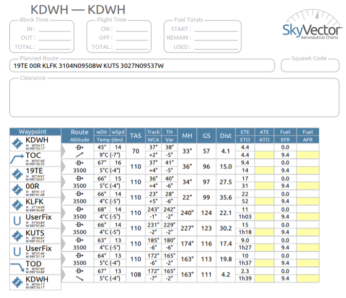
The sheets are used to track your progress. ETE and ETO are your estimated times for each leg of the flight and estimated time into the flight each waypoint should be crossed. ATE and ATE are your actuals. When you take off, you set a timer to track your progress. The GPS and the transponder both keep timers for you, but many pilots use a timer too. I keep my hand-calculated sheet on a kneeboard so I can write down the actuals.
I just have to figure out how to add in time for stops.
 WilliamsSW
> TheRealBicycleBuck
03/16/2019 at 23:22 |
|
Once again, great experience!
Never take off against the grain at a non towered airport. I’ve done it at KPWK ( towered) where it’s not uncommon to have takeoff s departing 34 and inbound landing 16, ( there’s a little airport in the way to the south called O'Hare) and that is NOT fun!
I gotta believe your flight planning software allows you to enter forecast winds and estimated stops - that, or delete it.
 TheRealBicycleBuck
> WilliamsSW
03/16/2019 at 23:37 |
|
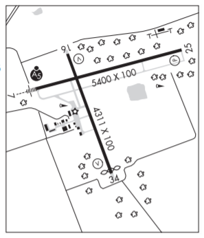
Some of the other pilots were talking about that kind of craziness going on at Lufkin. One said the last time he was there, someone was taking off on 7 while someone else was trying to take off on 34. I’m starting to reconsider using Lufkin as a stop.
 Chariotoflove
> TheRealBicycleBuck
03/17/2019 at 00:32 |
|
All this talk of using apps and software to calculate flight plans makes me want to call my dad and talk to him about it. The landscape sure has changed since I was little.
 WilliamsSW
> TheRealBicycleBuck
03/17/2019 at 00:39 |
|
Us
ing
34
or
25
seems
reasonable.
When
the
winds
are
120
at
5
I’d
stay
the
hell
away.
 NotUnlessRoundIsFunny
> TheRealBicycleBuck
03/17/2019 at 03:55 |
|
That’s exciting, congratulations!
And thanks for sharing your adventures. One of these days I’ll get my license.
 itranthelasttimeiparkedit
> TheRealBicycleBuck
03/17/2019 at 10:20 |
|
Its a good restaurant. For airport food =p